Seabed 2030: Atlantic and Indian Oceans Regional Center (AIORC)
The Atlantic and Indian Oceans Regional Center (AIORC) of the Nippon Foundation - GEBCO Seabed 2030 Project. A global initiative relentless in the pursuit of achieving a complete map of the ocean floor by 2030.
The Nippon Foundation-GEBCO Seabed 2030 Project (Seabed 2030) is a pioneering initiative accelerating ocean mapping efforts. We are a global community working with partners across industry, governments, research, philanthropy, NGOs, and civil society to achieve a complete map of the entire seabed by 2030. Seabed 2030 is a flagship program of the United Nation’s Ocean Decade of Ocean Science for Sustainable Development (2021-2030).
Data compilation for Seabed 2030 is led by Regional Centers who are are responsible for championing mapping activities, assembling and compiling regional ocean mapping information, and collaborating with existing mapping initiatives within their geographical areas.
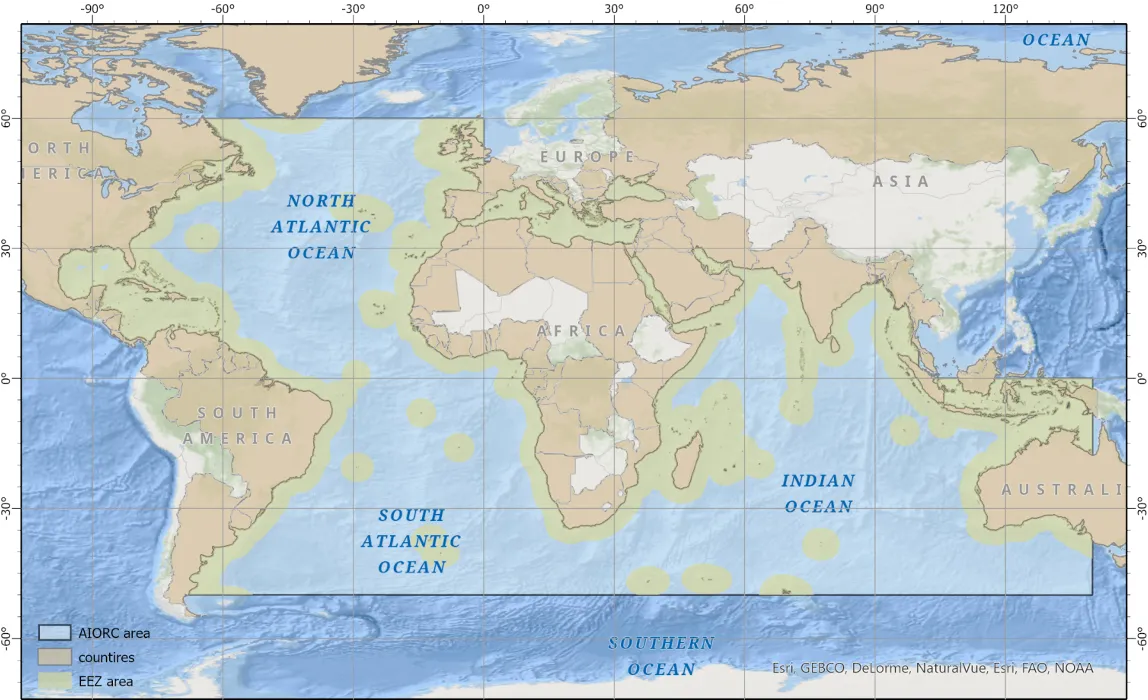
Covering an area of more than 140 million km², the Atlantic and Indian Oceans Regional Center is based at the Lamont-Doherty Earth Observatory of Columbia University, USA. Its remit extends from 60°N to 50°S, from the Americas in the west to Australia in the East (to 140°E).
●Total area of ~140.7 million km2 (~39% of the global ocean)
●EEZs cover ~53.9 million km2 (38%) of the region
●Bounded by 117 countries on six continents
We have developed an interactive map that shows progress made with each release of the GEBCO grid since the start of Seabed 2030 - explore it here.
The NSF-funded Global Multi-Resolution Topography Synthesis (GMRT) also part of the Ferrini Data Collaboratory, contributes data to Seabed 2030 and utilizes the GEBCO grid as one of its data sources.
Atlantic and Indian Ocean Regional Center WebApps
